Through the Rainforest: The Trans-Peninsular Route
N.B. This article first appeared in Muzings 2022, the annual publication of Museum Volunteers Malaysia
…The following year, while Scott sailed for Burma on the Blake, loaded up to its full 250 tons with guns on behalf of the sultan of Queddah, Light took the overland route from Thalang to Thonburi to personally deliver a consignment of guns, at the invitation of the King himself.
His journey was by way of a surprisingly accessible track long-established for trade goods, particularly tin. This long-established tin route was ideal for heavy loads. Pontoons loaded with weaponry were floated across the narrow northern channel between the island and the Phang Na mainland, where teams of elephants dragged the great pallets across a well-cleared pathway to the mining town of Takupua. There they continued via the Khao Sak Pass down to Phanom, to be loaded onto river boats and transferred to the sea at the port of Ao Ban Don.
At the jetty, ships were waiting to transport the goods north across the gulf to the Chao Phraya river, while an elegant royal launch stood ready for Captain Light himself. The trek across country had taken seven days in all; it would have taken weeks to sail south through the Straits and up the eastern Peninsula. But more crucially – would a cargo of weapons have survived the sea route? It was hard to imagine that the Dutch or the Bugis, the Illanun or the Siaks – or any other random orang laut – would not have got wind of such a treasure in their waters. This was the safest and most secretive method of shipping such commodity…
From Pearl, Chapter 10 , ‘A Servant of Two Masters’.
In 1774, Captain Francis Light, for once deserting the sea, took a land trek across the Isthmus of Kra from west coast Phang Na province across the Khao Sak Pass to Ao Ban Don (a port on the Gulf of Siam) from where he took sea passage to Thonburi (Bangkok). He travelled by elephant and river, following a well-trodden path in use for generations that by the 18th century had become the main tin route between the west and east coasts. Light later proposed that the East India Company should consider this alternate route for their China trade, stressing the speed and safety of a trans-peninsular crossing at a time when the Straits was becoming increasingly fraught due to Dutch and Bugis hostilities and pirate activity. Light believed that a British establishment on the north west of the Straits – at this date he still favoured Junk Ceylon (Phuket) over Penang – would keep British trade free of encumbrances if they travelled through the forest instead of sailing around the Peninsula to the South China Sea.
Crossings through the rainforest in several key locations on the Malay Peninsula were not new and had been in existence since the earliest times. Although perceived wisdom tells us that the sea has always been the driving force of trade contacts in South East Asia, routes through the interior had always been an integral part of mercantile and cultural exchange, a necessary complement to the maritime routes.

Elephants crossing forest in Thailand (working abroad.com)
Even before the fifth century CE, there is believed to have been a trans-shipment route between Kedah and Yarang, by way of the Merbok and Patani rivers. Now much reduced in modern times by silting, these rivers were once wider and reached further inland, requiring only a short haulage between the two to complete the journey. Another suggested path during the heyday of the Bujang Valley civilisation stretched from Ligor in the north east via Takuapa (Phang Na) on the west coast and then on to Kedah. Traversing the land sectors, often through dense forest, would no doubt have required the assistance of the communities living in the interior. Thus, an indigenous economy would have evolved, which included the barter of forest products in return for food and other commodities as well as the regular labour demands for haulage and the maintenance of the route.
This cross-cultural symbiosis exchanged more than goods: languages, religions, customs, and technologies were also part of the barter. It is interesting to note that while Chinese records of this period demonstrate a familiarity with the east coast of the Malay peninsula, they make little mention of Kedah, suggesting that early Chinese traders did not venture further than the east coast ports, and trade goods were brought to them via the interior routes. Indian merchants, however, may have made such journeys inland, which might explain why Indic culture made more impression on the peninsula at an earlier time than Chinese.
Jalan Penarikan

Map of the Penarikan Route by Maganjeet Kaur
(adapted from N. Rajendran,1969,9)
The historian Paul Wheatley, formerly professor at University of Malaya in Singapore, noticed that many old maps of the peninsula from 16th and 17th centuries seemed to indicate a wide canal running in a diagonal direction from the north east to the south west. He realised that this corresponded to the Muar and Pahang rivers, at that time separated only by a short neck of land less than a mile long situated around a small hill still known as Bukit Penarik (from tarek – to pull). He believed the canal was an error made by early cartographers– it was not a manmade waterway but an ancient inland route making use of the rivers to tranship goods from east to west. There would have been at least one portage between the two rivers, probably serviced by indigenous bearers.
Roads would have been a challenge to construct through such thick forests, but rivers made for ideal transport. Tuan Haji A. Shukor, in his ‘History of Muar’, believed that Jalan Penarikan played a vital role in the economic and military success of Malacca, aside from its important maritime location. Wheatley describes Pahang as a major source of gold, a commodity troublesome to ship by sea as it inevitably attracted the attentions of pirates and raiders. Instead gold was probably taken across the rainforest by means of rivers and portages to Malacca. Furthermore, other easily portable goods from Pahang, such as sappanwood, porcupine quills, nutmeg, camphor and pepper, which had high yield values in Europe, would have also followed this interior route. Jalan Penarikan would no doubt have continued northwards to Pattani, thus connecting the two main trading centres on either coast.
‘By the Panarikan route, one travels from Malacca to Pahang in six days’
Emmanuel Gordinho de Eredia (1563-1623), Portuguese chronicler and cartographer, who correctly identified Jalan Penarikan as riverine, not a manmade canal.
An expedition along the Penarikan 1968
In 1968, a sterling effort to rediscover Jalan Penarikan was made by a local historian, N. Rajendra, with the help of a group of four school boys and their teacher from Setapak High School, Kuala Lumpur. They anticipated that the journey would take six days as it had done for de Eredia, but it was not to be the case. In fact, their trek took eleven days and proved to be a difficult and backbreaking experience. Much had changed since the old days when this had been a well-travelled and regularly maintained waterway. They discovered that, apart from the silting one might have expected, there were many other obstacles, particularly logs of fallen trees, debris, sandbanks, and overhanging forest; in some areas the water was little more than an ankle-deep trickle. Many navigable stretches were still used by local orang asli communities who fished there in their dugouts; in parts they had netted or wired up entire sections to trap fish. These obstacles necessitated unloading their dinghy and carrying everything by land.
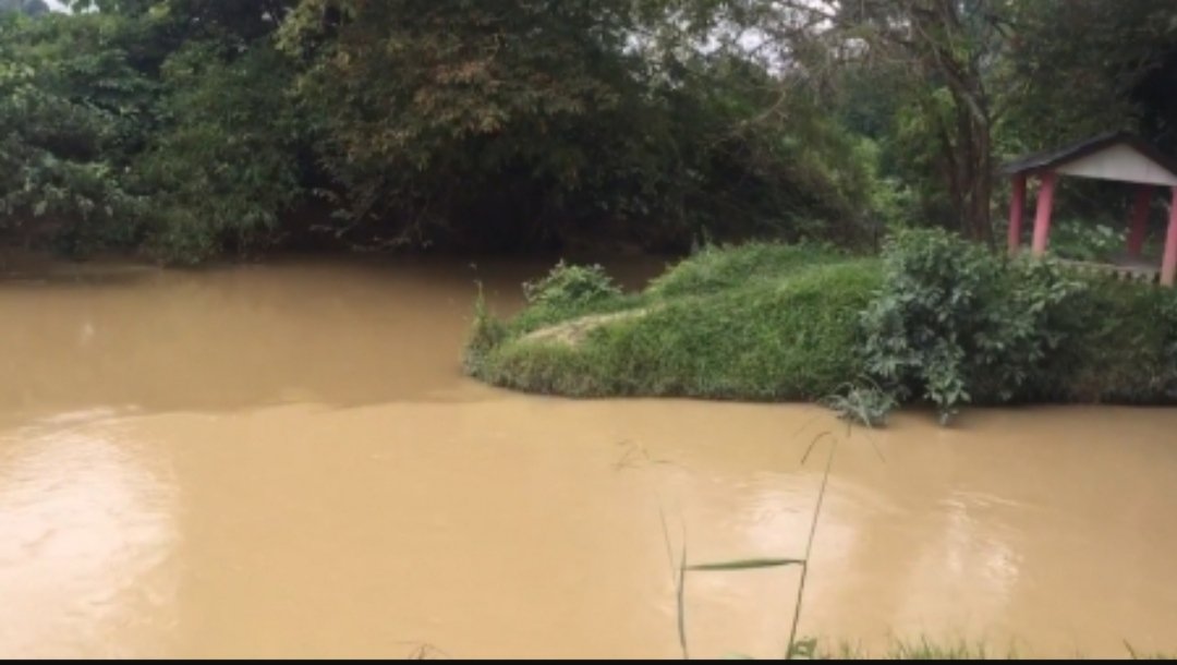
Confluence of the Muar and Jempol Rivers at the mid point of Jalan Penarikan today
Image: Namri Sidek (Wikipedia Commons)
Another potent danger was crocodiles; one member of the party had to be on lookout duty at all times with a pair of binoculars. At a place called Buloh Kasap they finally had to give up and go by road to Kemayan; the next stretch of the river was impossible to navigate, about 15 miles in all. Locals said ‘only demons and pythons live there.’ At last, they reached the main Pahang River, daunting in itself because it was so wide in comparison to the narrow streams they had been navigating. The Pahang is also famous for its many crocodiles, although they were encouraged to learn that a local bomoh (shaman) had ‘consulted’ with the largest crocodile, an ancient fellow known as Lubok Puka, and travellers were generally left alone. Perhaps the bomoh’s charm worked after all, because on the 11th day they finally made Pekan safe and sound.

River Crocodile, Pahang River, Malaysia
Although they had only traversed about three quarters of the route because of the many challenges blocking their path, this expedition clearly demonstrated that the Jalan Penarikan had once been possible. When it had been a thriving waterway, there would have been constant maintenance by locals clearing debris and logs, digging channels and cutting back undergrowth.

Pahang River at Kuala Lipis, circa 1910. Leiden University Library, Public domain, via Wikimedia Commons.
The Kra Canal Project
In modern times when fast Malaysian highways have already linked the east and west coast in several places, river transport through the forest is no longer necessary. But interestingly enough, the idea of a manmade waterway across the Peninsula has never quite been abandoned. For the last five years, the Isthmus of Kra project In southern Thailand has been quite the South East Asian hot potato. The plan to construct a canal across the narrowest point of the peninsula from Satun in the west to Songhkla in the east has generated fierce debate on all sides.

Projected plan for the Kra Canal
(Image: https://www.iims.org.uk/kra-canal-project/)
The first time such a canal project was mooted had been as early as 1677, when the king of Siam ordered a French engineer, De Lamar, to draw up plans. In 1882 Ferdinand de Lesseps (of Panama Canal fame) was consulted. In the modern era, the World Bank and the Asian Development Bank have looked into it. There was even a Japanese proposal to use nuclear excavation to undertake the construction.
Undoubtedly there are advantages to such schemes. A canal link between the Indian Ocean and the South China Sea cuts 1200 kilometres off the sea journey through the Straits of Malacca, easing the congestion and pollution caused by the 80 000+ vessels that ply the route annually, comprising 30% of the world’s global trade. A land route also avoids the dangers of piracy that still exist in the Malacca-Sunda-Lombok Straits.
The counter argument, however, is equally persuasive. A project of this magnitude would have serious ramifications both to the ecosystem of the forest and to the geopolitical security of the region. To cut through 44 kilometres of forest itself is no mean feat. Much of the mountainous interior is at a high elevation of at least 75 metres, forcing the canal to wind around natural contours, increasing its length to possibly as much as 100 km. To allow for the draught of modern container shipping, the waterway would require a depth of at least 35 m, and width of at least 500 m. Imagine the environmental cost, not to mention the expense of constant dredging, that would be required to maintain such a channel! Many also believe that revenue generated would ultimately not be sufficient to justify the investment and long-term ecological damage.
There are other even more controversial considerations. The Memorandum of Understanding (2015) between the governments of Thailand and China, part of the ‘Belt and Road Initiative’, proposed a $28 billion-dollar, ten-year project which would leave Thailand massively indebted to China – and would increase geopolitical tensions in the region, particularly between China and India. Singapore and Malaysia were concerned at the impact on their trade in the Straits. The US objected to the strategic imbalance that could result from China’s direct access to the Indian Ocean. Thailand feared the consequences of falling into a debt trap that would leave them potentially caught in the middle of a conflict between India and China, further intensified when India began to fortify bases in the Andaman and Nicobar Islands against possible future activity of the Chinese navy in these waters.
After five years of debate, the proposal has been cancelled due to geopolitical and environmental pressure and the escalation of tensions, not to mention the enormous costs involved. But this hot potato has not been entirely discarded; in 2020, the Thai government announced that it was considering a rail link in place of a canal. The trans-peninsular route lives on!
Further Reading
Ian Morson, (1993) The Connection: Phuket, Penang and Adelaide. The Siam Society
Paul Wheatley, (2010 edition). The Golden Khersonese. University of Malaya Press
Journal articles
N. Rajendra (1969) Retracing the Penarikan Route. The Malaysian Historical Society .https://myrepositori.pnm.gov.my/bitstream/123456789/2086/1/MIH_1969_Mac_2.pdf
Online Articles
Nidhi Agrawal (2020), Thailand Cancels the Kra Canal Project. I.A.S Articles https://www.iasarticles.com/2020/09/thailand-cancels-kra-canal-project.html
Luc Verley. (2015). The Kra Canal Project. International Institute of Marine Surveying (MIIMS). https://www.iims.org.uk/kra-canal-project/